Maps of the Occupied Areas
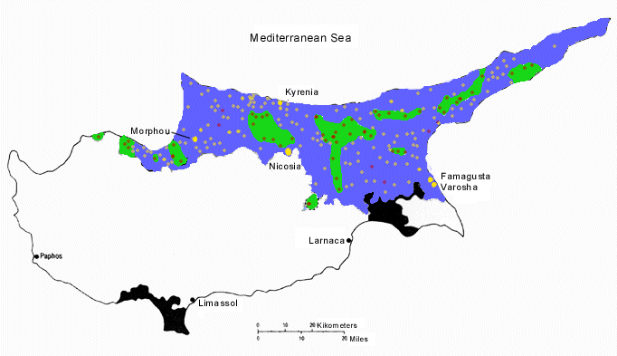
Above: Population of occupied Areas Before the Turkish Invasion
Key:
Gold = Villages with a Greek Cypriot Majority
Red = Villages with a Muslim Cypriot Majority
Blue Greek Cypriot Majority
Greek Muslim Cypriot Enclaves
(Note that the North Nicosia Muslim enclave was Ethically Cleansed of its original Armenian majority population in 1963.)
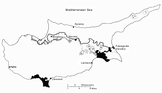
Above: Map of G/C and M/C "States" from Boutros Ghalis "Set of Ideas"
Key:
north of thick black line = new MC "zone"
south of line is returned GC land
dotted lines = GC and MC enlaves in each zone
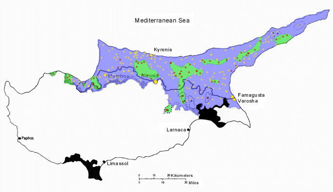
Above: The Two Maps Superimposed showing Clearly that the Majority of the Occpied Villages will continue to be under Tukish Occupation in Ghalis Plan
(Also Notice that a NON EXISTENT Muslim Enclave has been Created in the buffer zone [east] which comprises of land belonging to the Greek Cypriot villages of Arsos and Tremetousia.)
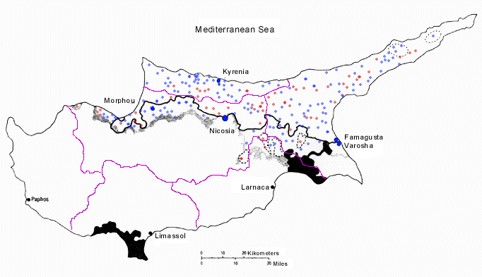
Above: Maps Superimposed showing Existing District Bounderies
Key:
Blue = Villages with a Greek Cypriot Majority
Red = Villages with a Muslim Cypriot Majority
Purple = Distict Bounderies
||How You Can Help||
||Home Page||Index||Introduction||Human Rights||United Nations||Turkish Viloations||Greek Myths||Greek Dances||Greek Radio||Northampton||